Straughan address review
01 · Resource Details
Description
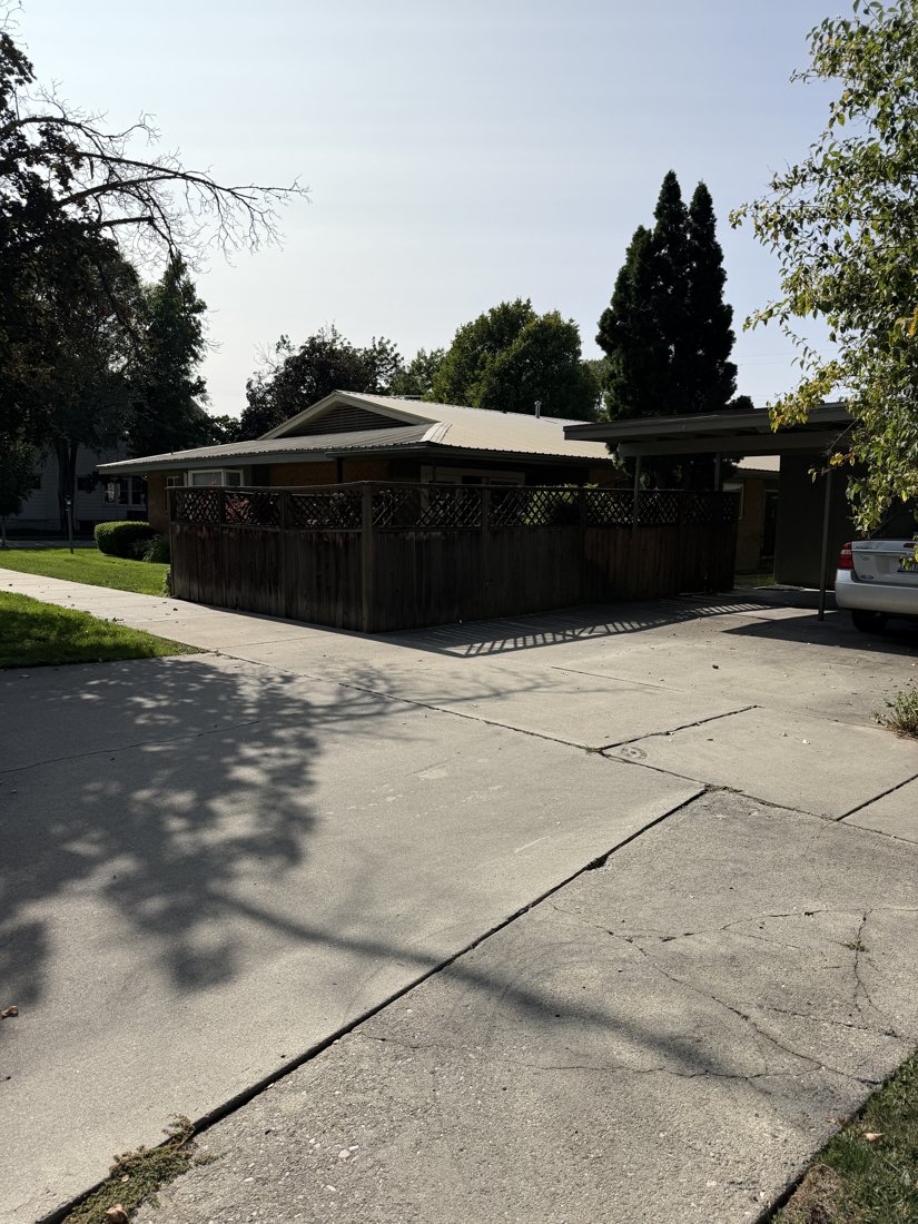
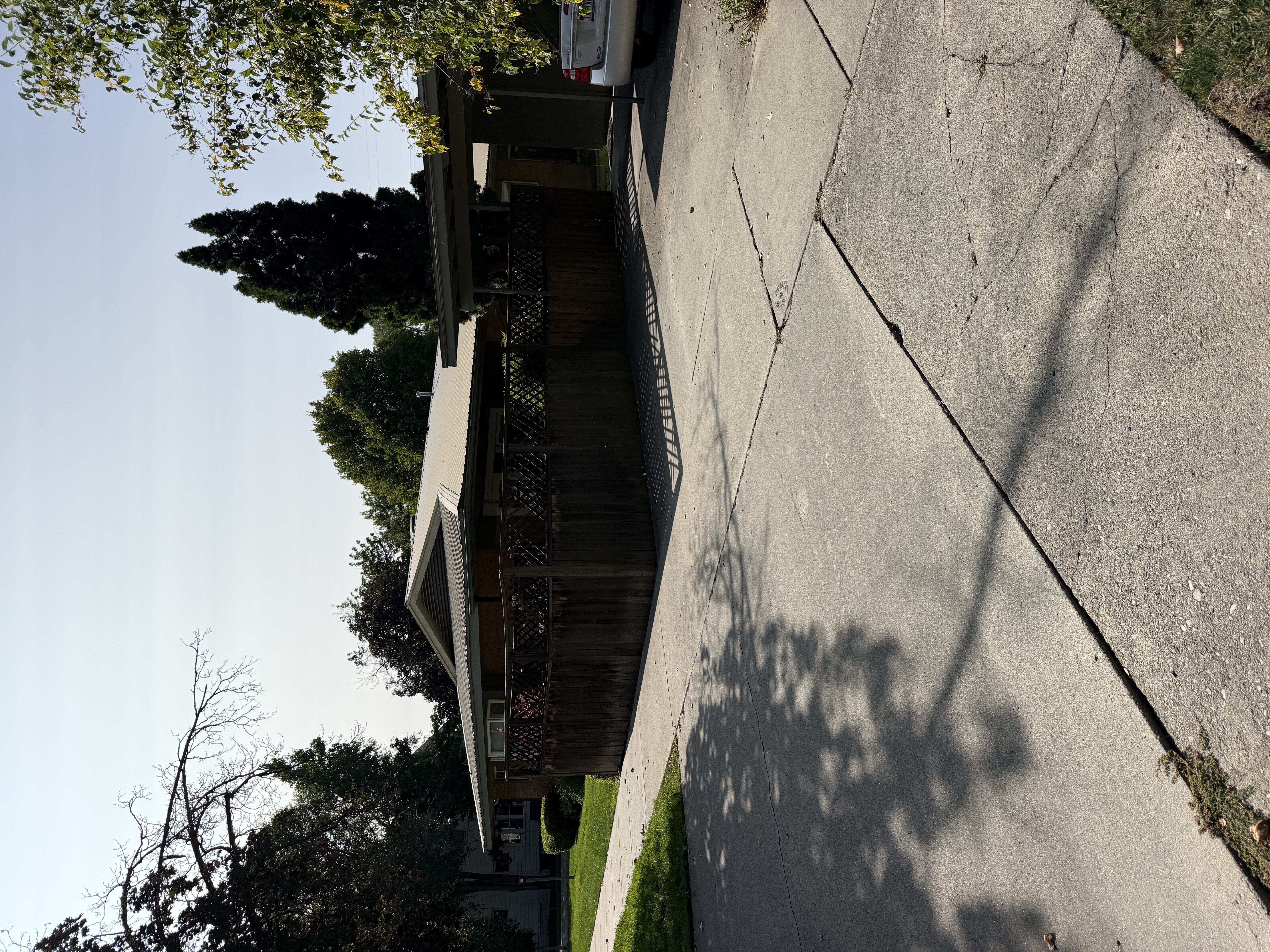
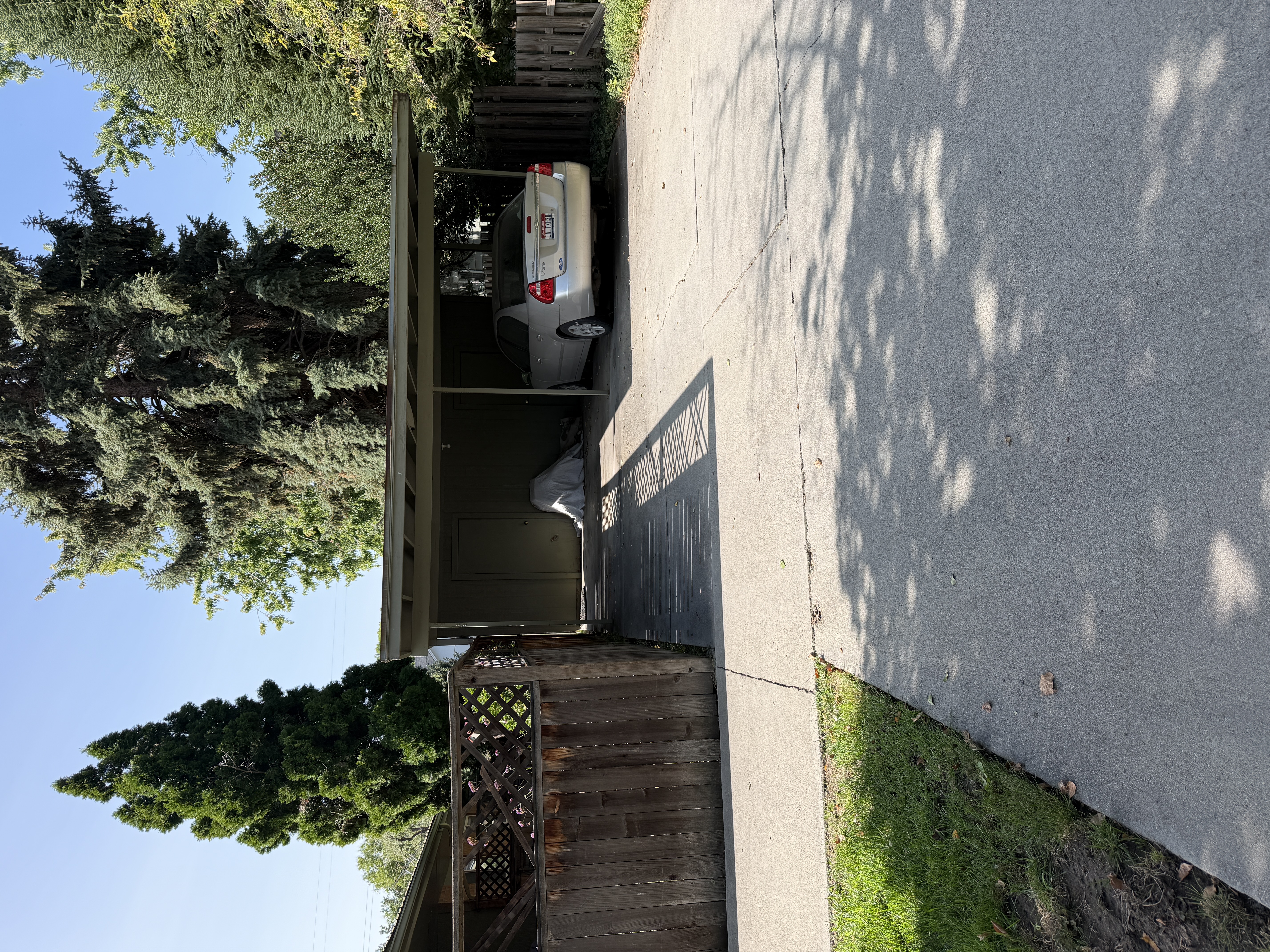
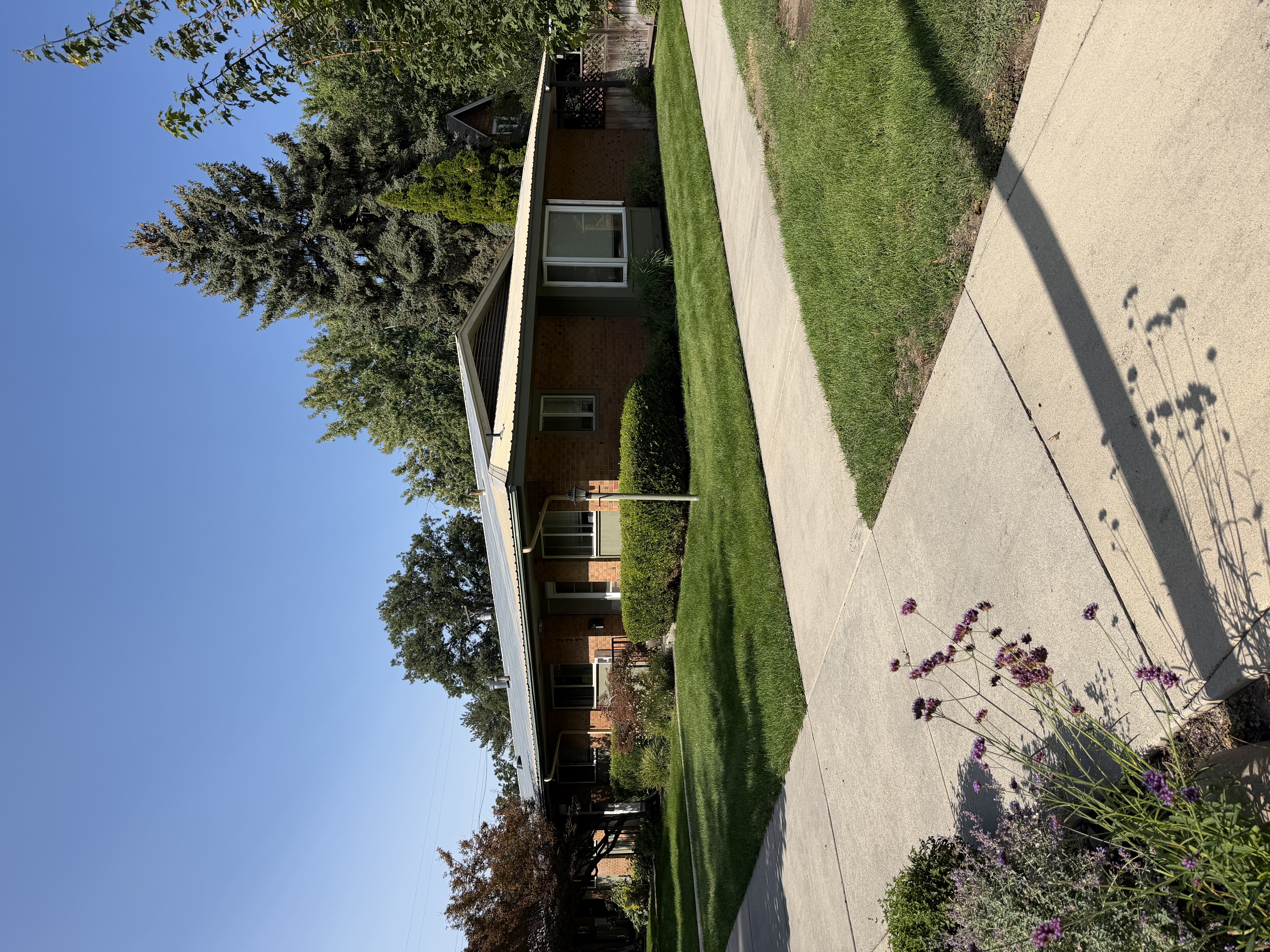
Siting and Setting Description: The property lies within Boise’s East End on an angled street grid, fronting N Straughan Avenue. The group extends along Straughan between the Jefferson corner and the interior alley. A lawn and narrow planted border separate repeated entrance walks from the sidewalk. Fenced patios occupy the ends, while concrete aprons provide access to open carports. The visible ground is approximately level. The applicable neighborhood development era is not documented in the supplied record. Main Building Description: The residential group extends to the corner of N Straughan Avenue and E Jefferson Street. Individual corner or mid-block lot positions are not evident because parcel divisions remain unresolved. Its principal façade faces southeast, fronting N Straughan Avenue. The construction date is unknown. The one-story residential group has elongated brick-faced walls, repeated entrances, and a low roof with broad overhangs. A narrow concrete base is apparent below the brick. Structural masonry versus framed construction behind brick is unresolved. The principal footprint is broadly rectangular, with an end window bay and attached or closely related patio roofs. Ribbed sheet metal covers low roof planes, including raised gabled portions. Broad sliding-window groups alternate with entrance doors, and opaque panels extend below some windows. The narrow window frames appear to be metal, although all assemblies cannot be identified. Separate concrete walks reach the doors under the projecting eaves. End patios have board fencing, and open carport/storage structures stand at opposite ends of the group. The contributing determination remains pending for the reasons described below. Features: – Overall Massing: The elongated single-story frontage and repeated door-and-window rhythm establish a horizontal residential group. A projecting glazed end bay and carport roofs vary the otherwise low profile. – Roof Form and Details: Low sloping roofs have broad boxed eaves and raised gabled portions with louvered vents. Ribbed sheet-metal roofing is visible across the main planes. Narrow posts support extensions over portions of the patios. – Cladding Materials: Brick laid in horizontal courses covers the main walls. Opaque infill panels occur below broad windows and at the projecting end bay; their exact substrate is unresolved. Wood boards and lattice enclose patios. – Fenestration and Window Details: Broad multi-part sliding windows alternate with individual entrance doors. Narrow frames appear metallic. The end bay has tall glazing, while smaller windows occur along secondary walls. The legal unit count cannot be inferred solely from the repeated openings. – Porch or Entry Treatment: Individual concrete walks reach repeated doors beneath deep eaves. End patios have roof extensions, slender posts, and board enclosures. A conventional full-width raised porch is absent. – Foundation: A low concrete base is apparent beneath the brick walls, keeping the floor close to the lawn and entrance walks. – Style Elements: The one-story scale, broad eaves, horizontal brickwork, repeated glazing, and integrated parking support Ranch-type multifamily character. A mid-century construction period is plausible but not established by the photographs. Summary of Known or Observed Alterations: – Unknown date: Ribbed sheet-metal roofing may be a replacement covering. The preceding material and installation date are not documented. – Unknown date: Board fences, lattice screens, and patio roof supports appear to reflect changes to the end outdoor spaces. Their construction sequence and relationship to the original design are unresolved. – Unknown date: Window and opaque-panel assemblies vary across the frontage. Replacement extent cannot be established without comparison photographs. Garage Description: Two open carport/storage structures appear in IMG_2831 and IMG_2839 at opposite ends of the group. Each has a low roof supported by slender posts above an approximately two-bay concrete parking area, with an enclosed storage wall and pedestrian doors at the back. The roof surfaces and wall-panel substrates are not fully visible. One carport is approached from the Jefferson side and the other from the alley side. Their allocation to individual addresses, attachment to the residential building, dates, and contribution remain unresolved. These are open carports rather than confirmed enclosed garages.
02 · NRHP Evaluation
Justification of Significance and Integrity
Read / select text · 2,382 characters
Statement of Significance: The construction date is unknown. The group’s potential architectural interest lies in its horizontal brick frontage, repeated entrances and window groups, broad eaves, and end parking arrangements. Those features distinguish it from the block’s individual gabled houses and may represent a later multifamily phase of neighborhood development. A Criterion C evaluation requires confirmation of the resource boundaries, construction period, and the district context relevant to that residential type. Contributing Determination: The low brick form and repeated entrance rhythm remain legible, but a contribution determination cannot yet be assigned responsibly to individual addresses. The map labels 217, 219, and 221 conflict with the photographed 223, and building, unit, and carport divisions are unresolved. The next review must establish the resource being evaluated and its date. The present architectural record supports that review without multiplying one photo group into unverified legal resources. Evaluation of Integrity under Criterion C: – Location: The group’s present relationship to Straughan, Jefferson, and the alley is clear. Individual parcel limits and original-site retention remain unverified. – Design: The horizontal massing, repeated entrances, and broad eaves remain readable. End patio enclosures and variable opening assemblies complicate a comparison to the original design. – Setting: The street lawn, sidewalks, direct entrance walks, and end parking areas preserve a coherent residential arrangement within the block. – Materials: Brick walls remain visible across much of the frontage. Metal roofing, opaque panels, and window assemblies require chronology review to distinguish original work from replacements. – Workmanship: Regular brick coursing, restrained eave detailing, and repeated openings express the group’s construction character. Elaborate decorative workmanship is not the proposed basis of significance. – Feeling: The low brick frontage and integrated parking retain the visual character of a Ranch-type residential group, while fencing and roof changes affect the end views. – Association: A possible association with multifamily neighborhood development is visible in the layout. Its historic period and the precise resource boundaries must be documented before a Criterion C determination.
03 · Property, Construction & Use
Construction Activity / Event Information
Feature Information
Feature Description
Read / select text · 342 characters
– (1) observed elongated residential building or connected group; legal unit divisions and contributing determination pending – (2) open two-bay carport/storage structures, observed at opposite ends of the group; attachment, ownership, and contribution unresolved. Feature Count is a provisional physical count, not a legal parcel inventory.
Function / Use
04 · Materials & Architecture
05 · GIS & Districts
Map 1 places this record within the Bruce–Straughan / Jefferson–Bannock block. Camera GPS locations identify where photographs were taken; they are not parcel boundaries or resource-center coordinates.
06 · Photos · 10
Camera directions describe the view. The façade direction appears in the building narrative. Downloads contain the original photograph, not the smaller display image.
North and west sides, viewed from the southeast. Oblique end view of the brick residential group, fenced patio, low gable, and adjacent carport.
Assignment & original metadata
Unresolved address group
223 visible in IMG_2832-2834; earlier map labels conflict.
Original: IMG_2830.JPG
Captured: 2026:09:08 11:16:46
Camera GPS: 43.61047777777778, -116.18554722222223
Camera direction: SE · 152.72035214914553° T
SHA-256: 2032d48060b3f742decef3596d0f29c4b0d6ae003f5dc5dc7649fdc1b2effe06
North and east sides, viewed from the southwest. Open covered parking bays and concrete driveway at one end of the brick group.
Assignment & original metadata
Unresolved address group
223 visible in IMG_2832-2834; earlier map labels conflict.
Original: IMG_2831.JPG
Captured: 2026:09:08 11:16:58
Camera GPS: 43.61044444444445, -116.18546388888889
Camera direction: SW · 209.0639494026704° T
SHA-256: 55e994ade28c3f229a2b694f90a261967f40edf2daa630a594f012dd3d1058c8
East side, viewed from the west. Oblique street view of the brick residential group with a projecting bay window and an entrance.
Assignment & original metadata
Unresolved address group
223 visible in IMG_2832-2834; earlier map labels conflict.
Original: IMG_2832.JPG
Captured: 2026:09:08 11:17:23
Camera GPS: 43.61032222222222, -116.18518888888889
Camera direction: W · 258.4208065458796° T
SHA-256: 8c958c7de6669805a4d3600be0aa5044956a786b8a5f65dbb8daefd183fff441
North and east sides, viewed from the southwest. Long street oblique showing repeated openings and an entrance.
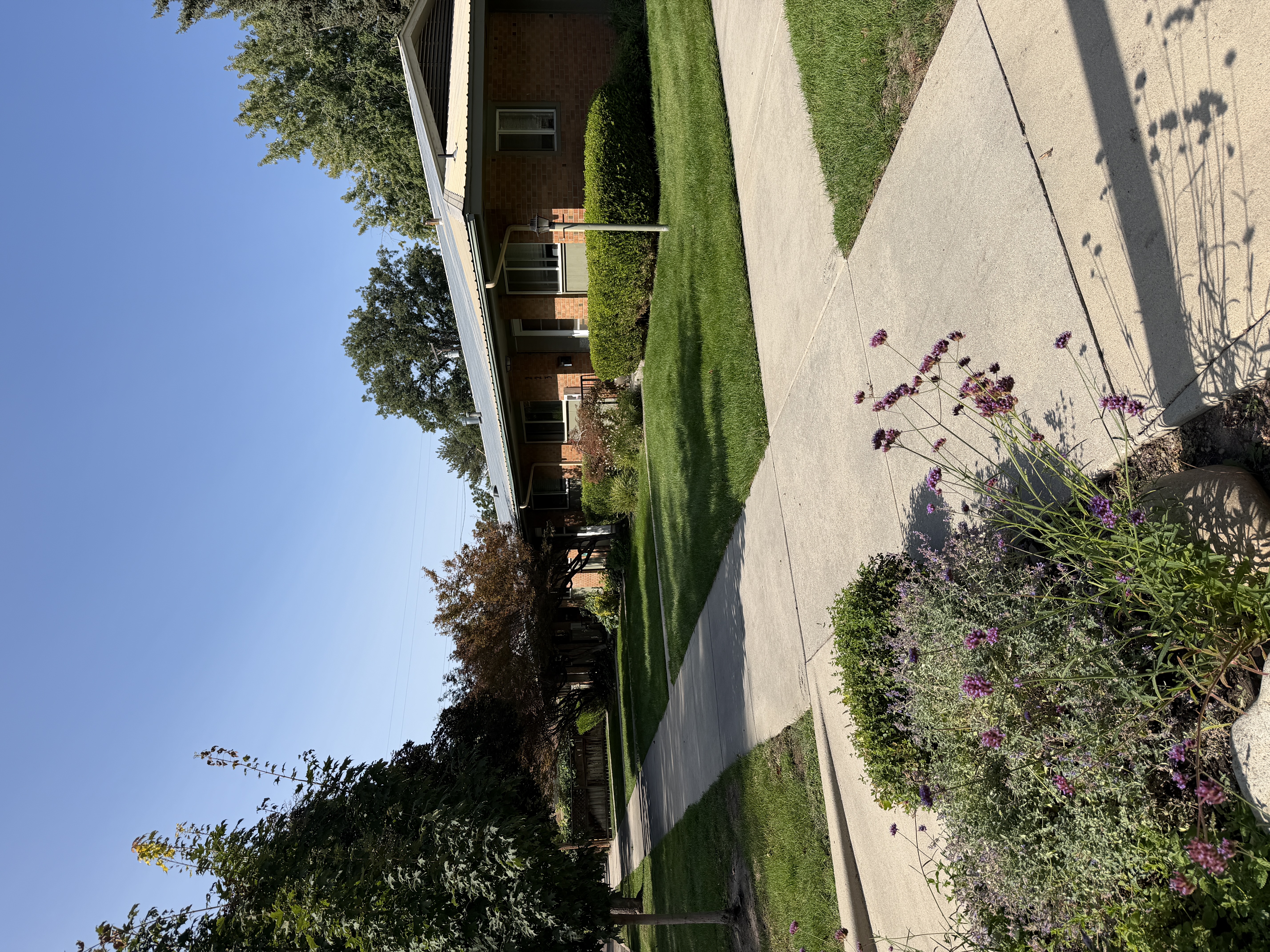
Assignment & original metadata
Unresolved address group
223 visible in IMG_2832-2834; earlier map labels conflict.
Original: IMG_2833.JPG
Captured: 2026:09:08 11:17:26
Camera GPS: 43.61032222222222, -116.18518888888889
Camera direction: SW · 242.19557195571954° T
SHA-256: 9547a5664ced3db755290ddfaa5e186417fd1ebb3a9625ebf04a3cc38be4330a
South and east sides, viewed from the northwest. Street elevation of the brick residential group with a doorway and adjacent windows.
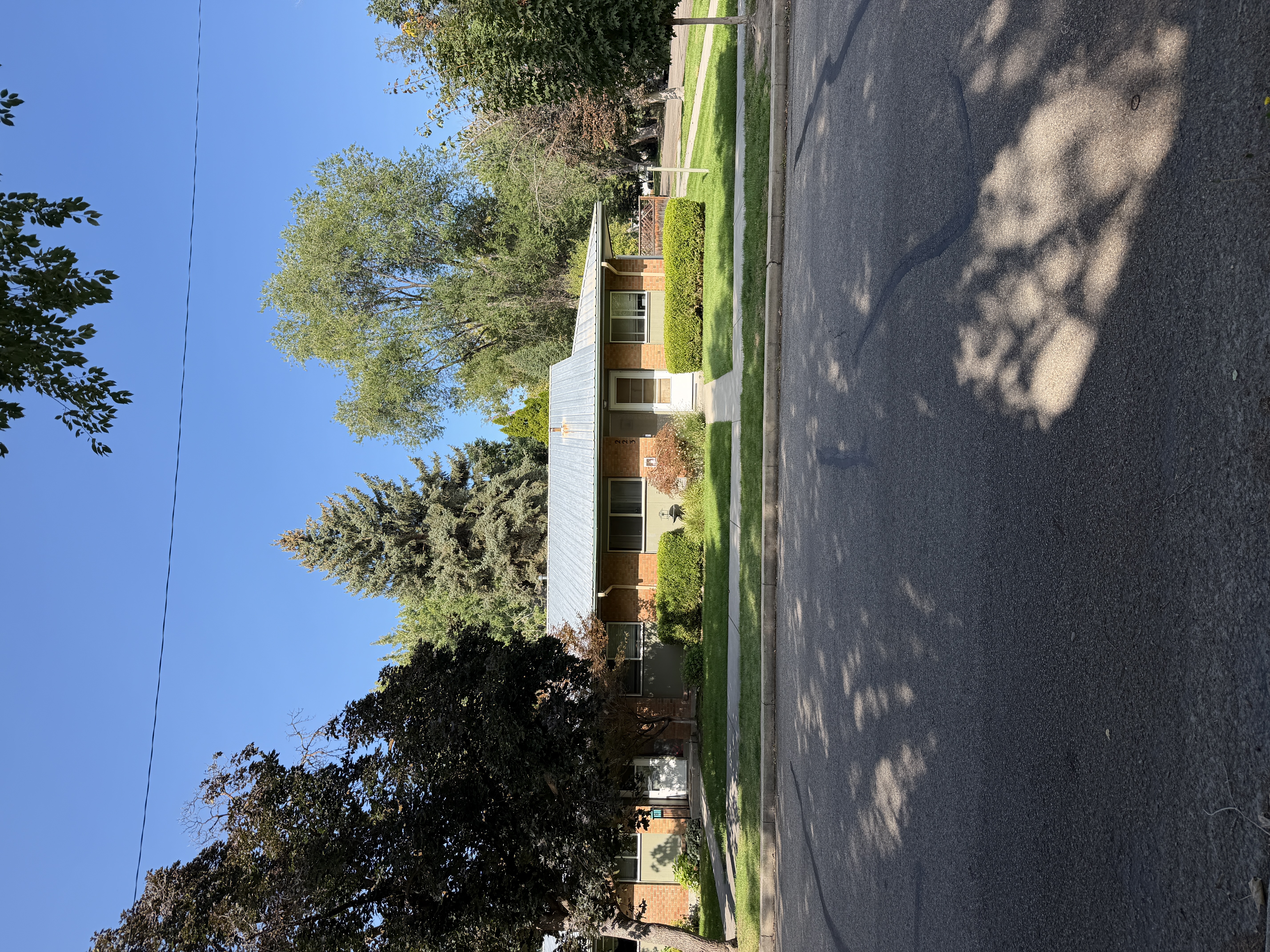
Assignment & original metadata
Unresolved address group
223 visible in IMG_2832-2834; earlier map labels conflict.
Original: IMG_2834.JPG
Captured: 2026:09:08 11:17:52
Camera GPS: 43.61016388888889, -116.18513611111112
Camera direction: NW · 299.95993031358887° T
SHA-256: e69a039338935d7d618b607050c0eb7f7c4c3567f95517315b4b5f8ed9bb249c
South and east sides, viewed from the northwest. Additional entrances and windows along the brick frontage, partly obscured by a parked car and trees.
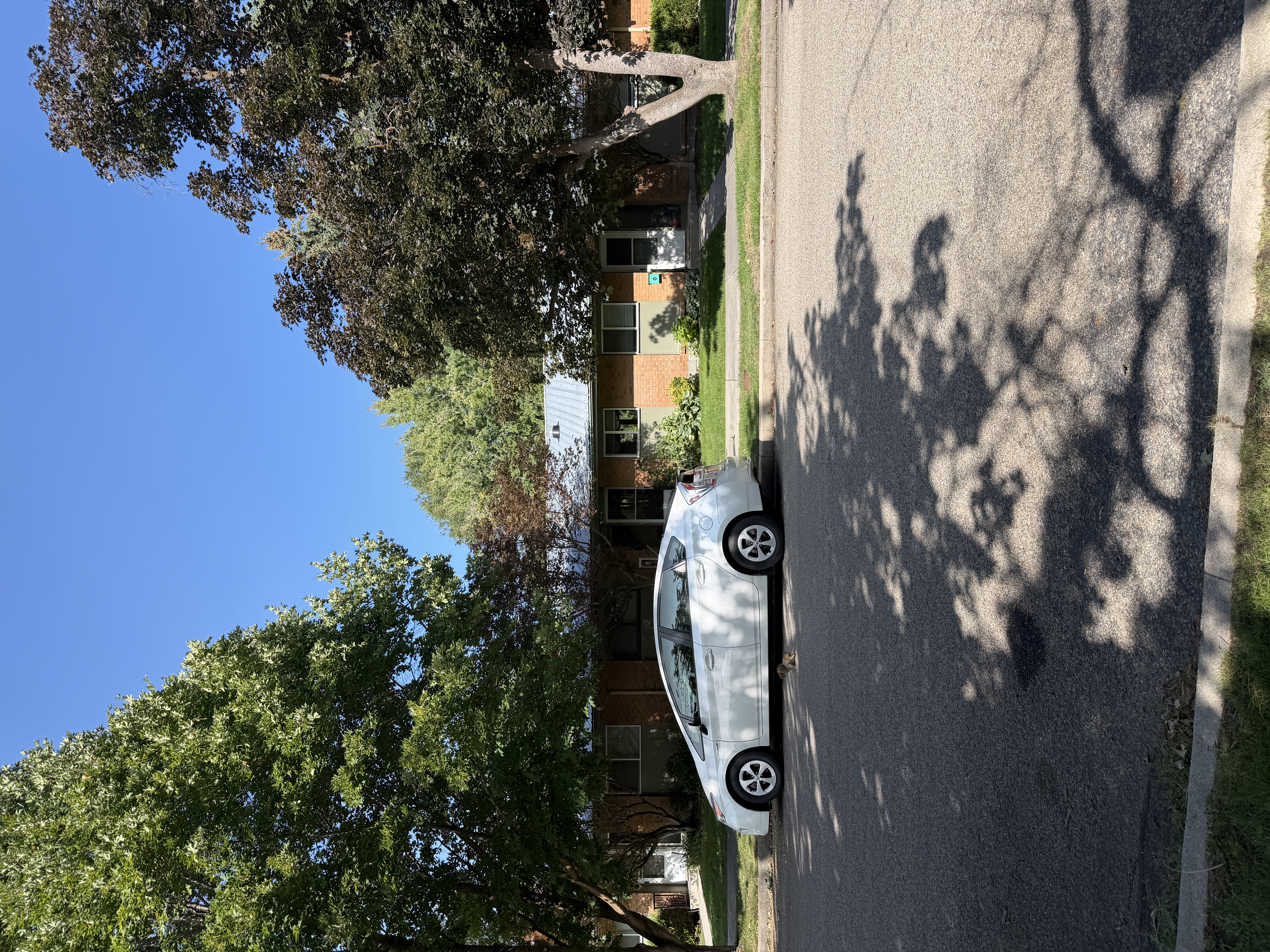
Assignment & original metadata
Unresolved address group
223 visible in IMG_2832-2834; earlier map labels conflict.
Original: IMG_2835.JPG
Captured: 2026:09:08 11:18:06
Camera GPS: 43.61006944444445, -116.18521111111112
Camera direction: NW · 300.49526989426823° T
SHA-256: 3e2d72a0f2accd20c9c82dfb8cc042e66b067d30453ba4514fffd40b156b01fc
South and east sides, viewed from the northwest. Alley-end oblique with brick end wall, screened patio, and low metal roof.
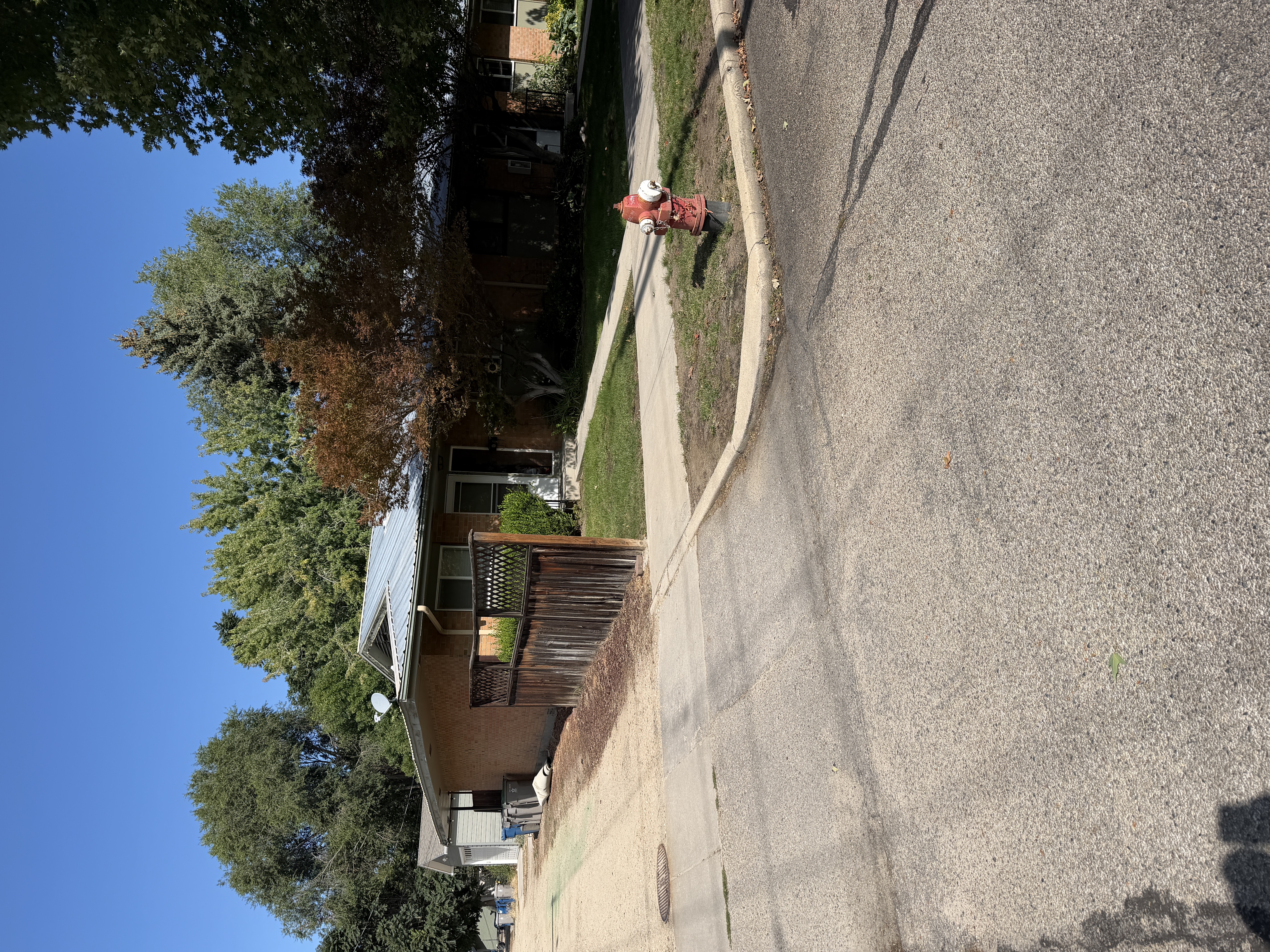
Assignment & original metadata
Unresolved address group
223 visible in IMG_2832-2834; earlier map labels conflict.
Original: IMG_2836.JPG
Captured: 2026:09:08 11:18:31
Camera GPS: 43.60993888888889, -116.18542500000001
Camera direction: NW · 323.99609375° T
SHA-256: 776fd813783066baf8dcf3a38deeb213396bfe13ac573138824994c9caeef807
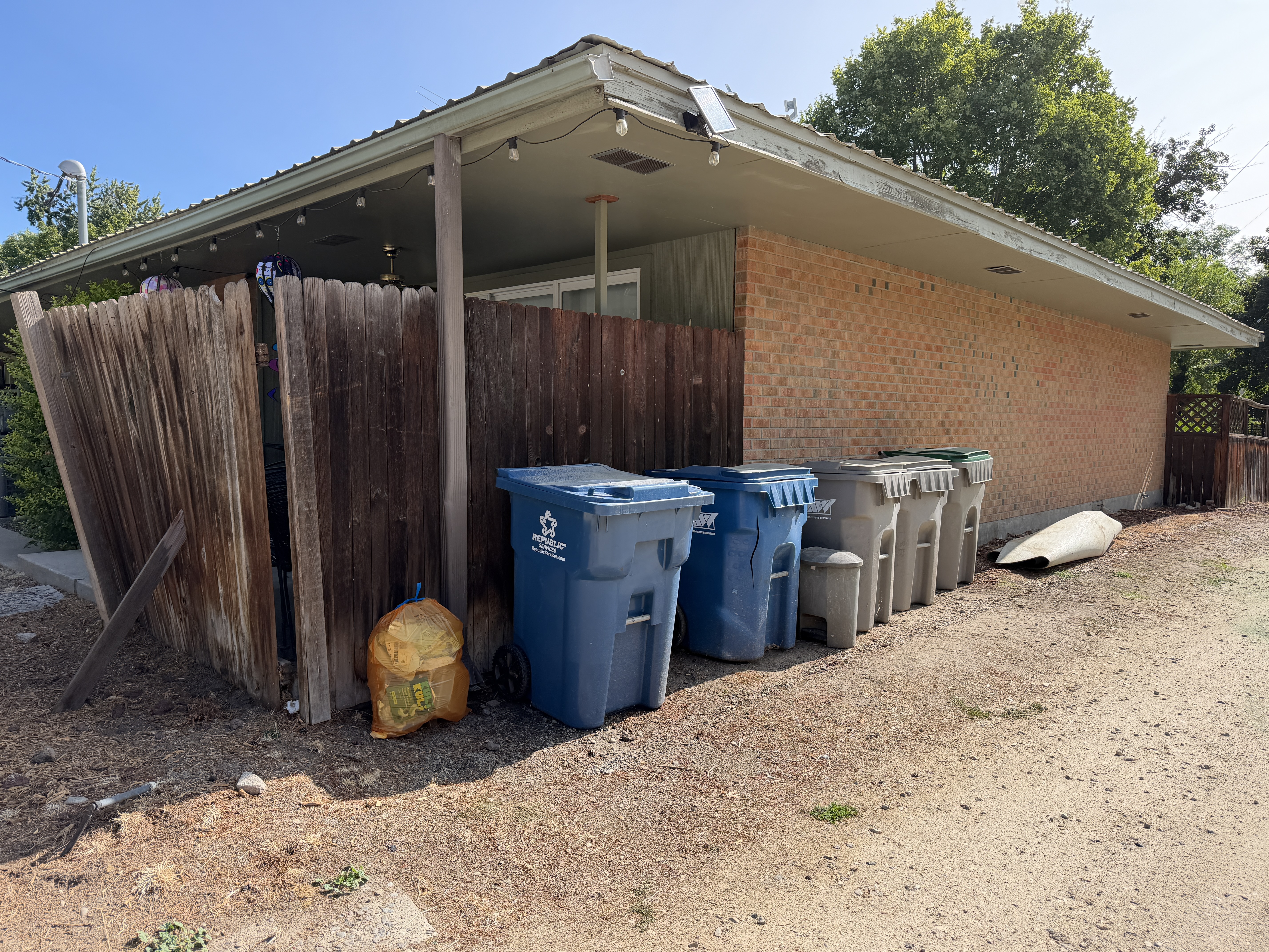
West side, viewed from the east. Alley service elevation with brick wall, deep eaves, fence, and refuse bins.
Assignment & original metadata
Unresolved address group
223 visible in IMG_2832-2834; earlier map labels conflict.
Original: IMG_2837.JPG
Captured: 2026:09:08 11:19:08
Camera GPS: 43.610086111111116, -116.18573888888889
Camera direction: E · 70.40756218905473° T
SHA-256: 6d97cac93883c4108eecef73266681fff4486c60b7653fb22a7ac46bbb2ac1ee
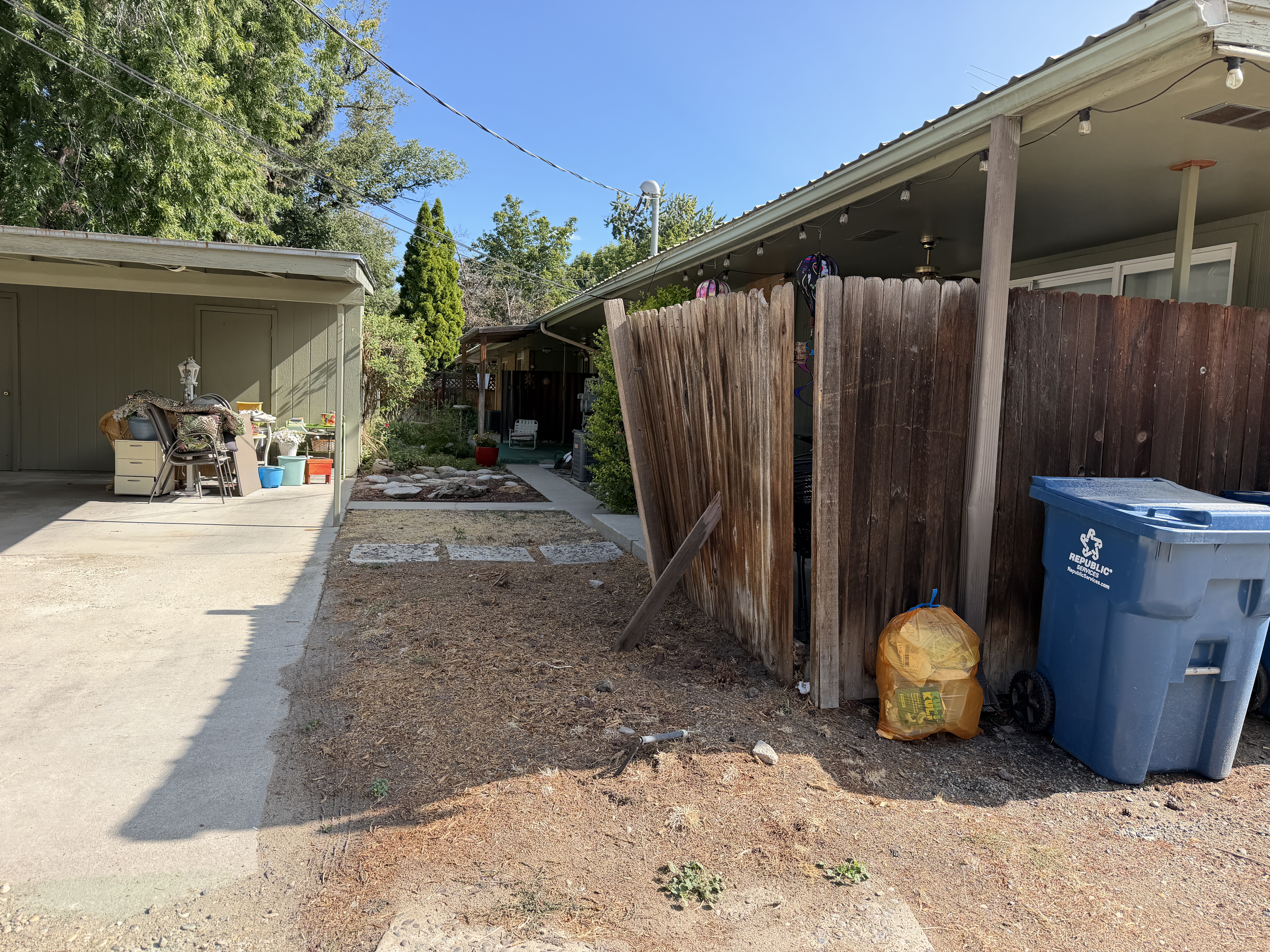
North and east sides, viewed from the southwest. Wider alley view relating the brick service wall to a nearby open parking structure.
Assignment & original metadata
Unresolved address group
223 visible in IMG_2832-2834; earlier map labels conflict.
Original: IMG_2838.JPG
Captured: 2026:09:08 11:19:11
Camera GPS: 43.610086111111116, -116.18574444444445
Camera direction: SW · 238.3431855500821° T
SHA-256: ab0d887fd843d4332ae7706bb41d9d6fecad503eeb1c79f9994c62b5e1174bcb
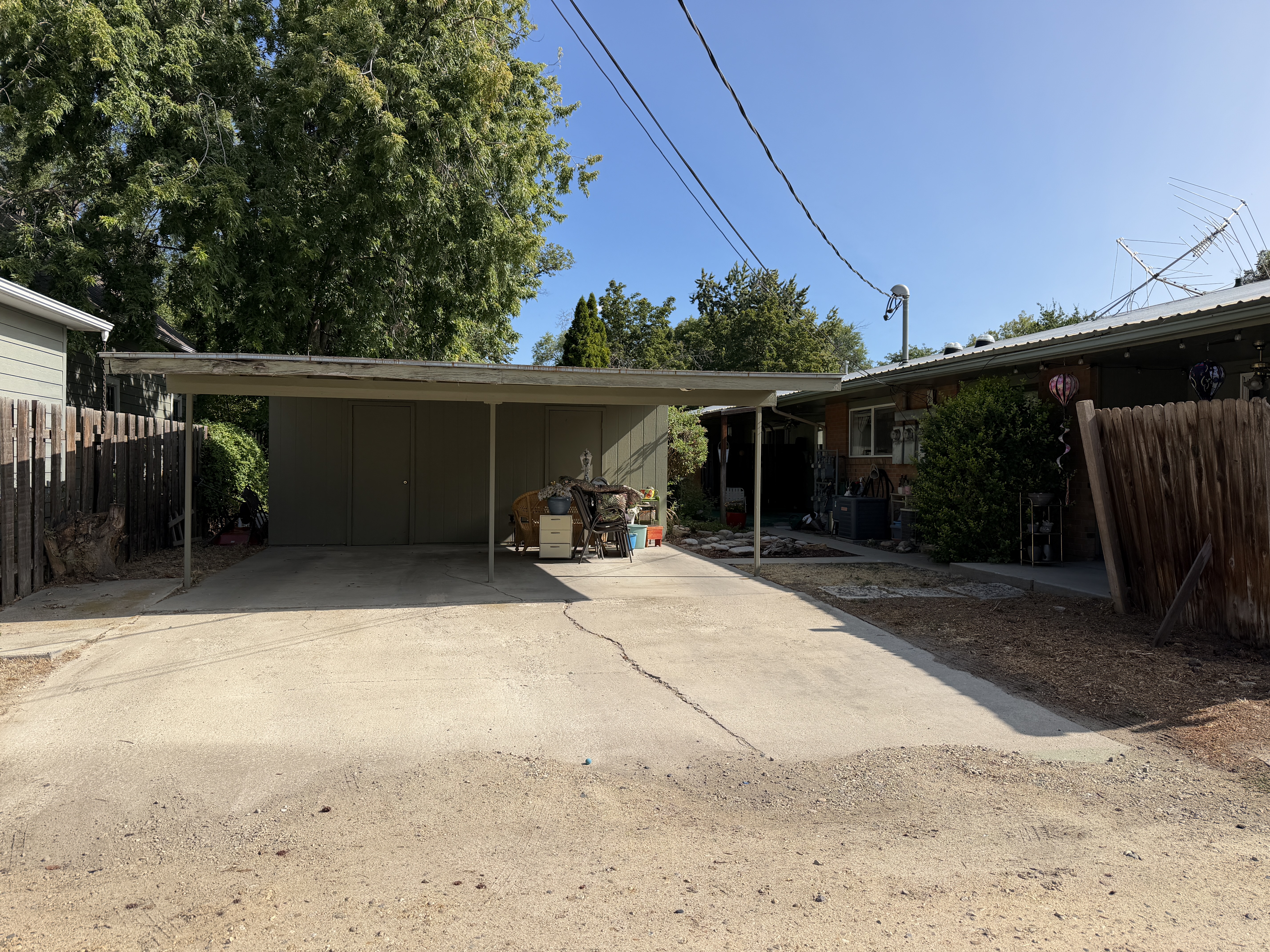
South side, viewed from the north. Open carport and paved court behind the brick residential group.
Assignment & original metadata
Unresolved address group
223 visible in IMG_2832-2834; earlier map labels conflict.
Original: IMG_2839.JPG
Captured: 2026:09:08 11:19:18
Camera GPS: 43.61008888888889, -116.18579722222222
Camera direction: N · 340.12095639943743° T
SHA-256: 5b3b614e2aa4636f80c8df1c17a6d7d5e3598bdb7ebe6b47f7afb92e3057604c